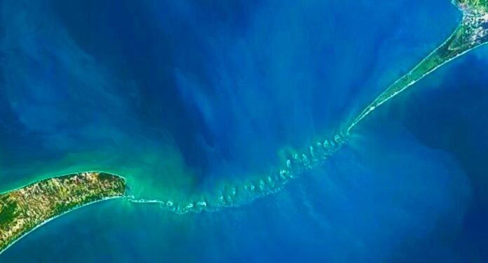
According to media sources, ISRO scientists create first undersea map of complete Ram Setu. Indian space scientists have come out with the most detailed map of the more popular as Ram Setu – hoping it will help resolve the long-standing controversies on the “origin” of the land bridge between India and Sri Lanka. The mapping exercise has led to the creation of the first ever undersea map of the entire 29 km bridge.
99.98 % of the Ram Setu, a 29-kilometer stretch of limestone shoals, is buried in shallow waters. Ram Setu spans from Dhanushkodi, Rameshwaram Island in India to the Mannar Island of Sri Lanka.
Image Source: Social Media
#dailyaawaz #newswebsite #news #newsupdate #hindinews #breakingnews #headlines #headline #newsblog #hindisamachar #latestnewsinhindi
Hindi news, हिंदी न्यूज़ , Hindi Samachar, हिंदी समाचार, Latest News in Hindi, Breaking News in Hindi, ताजा ख़बरें


